
- Your cart is empty
- Continue Shopping
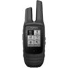


Garmin Oregon 600 GPS

Garmin Oregon 600 GPS
Garmin Oregon 600 GPS
Garmin Oregon 600 GPS is available in Bangladesh at Multimedia Kingdom.
Specification
| Physical dimensions | 2.4″ x 4.5″ x 1.3″ (6.1 x 11.4 x 3.3 cm) |
| Touch Screen | Yes |
| Display size | 1.5″W x 2.5″H (3.8 x 6.3 cm); 3″ diag (7.6 cm) |
| Display resolution | 240 x 400 pixels |
| Display type | transflective color TFT touchscreen |
| Weight | 7.4 oz (209.8 g) with batteries |
| Battery | 2 AA batteries (not included); NiMH or Lithium recommended, rechargeable NiMH pack (optional) |
| Battery life | 16 hours |
| Water rating | IPX7 |
| Memory | 1.7 GB |
| High-sensitivity receiver | Yes |
| Interface | high-speed USB and NMEA 0183 compatible |
| Base map | Yes |
| Way points/locations/favorites | 4000 |
| Track log | 10,000 points, 200 saved tracks |
| Routes | 200 |
| Sun and moon information | Yes |
| Area Calculation | Yes |
| Biometric Altimeter | Yes |
Take charge of your next adventure with BaseCamp™, software that lets you view and organize maps, waypoints, routes and tracks. This free trip-planning software even allows you to create Garmin Adventures that you can share with friends, family or fellow explorers. BaseCamp displays topographic map data in 2-D or 3-D on your computer screen, including contour lines and elevation profiles. It also can transfer an unlimited amount of satellite images to your device when paired with a BirdsEye Satellite Imagery subscription.
Adding more maps to Oregon is easy. Load TOPO U.S. 24K maps and hit the trail; add Trailhead Series TOPO maps and explore famous treks like the Appalachian Trail and the Pacific Crest Trail; plug in BlueChart® g2 preloaded cards for a great day on the water; or load City Navigator® map data for turn-by-turn routing on roads. Add satellite images to your maps with BirdsEye Satellite Imagery (subscription required). You can even display and enter grid references in Irish Grid (IG) or in the new Irish Transverse Mercator (ITM) grid.
Related products
 Out of stock
Save 4%
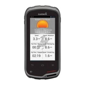
Garmin Monterra GPS
Original price was: ৳ 57,500.৳ 55,000Current price is: ৳ 55,000.
 Out of stock
Save 5%
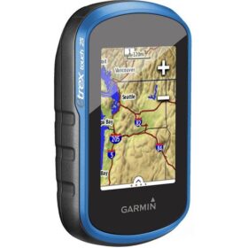
Garmin eTrex 25 Handheld GPS
Original price was: ৳ 29,500.৳ 28,000Current price is: ৳ 28,000.
 Out of stock
Save 6%
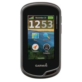
Garmin Oregon 650 Handheld GPS
Original price was: ৳ 62,000.৳ 58,000Current price is: ৳ 58,000.
 Out of stock
Save 1%
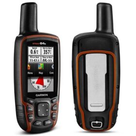
Garmin MAP64S Handheld GPS
Original price was: ৳ 37,000.৳ 36,500Current price is: ৳ 36,500.
 Out of stock
Save 14%
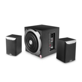
F&D A520 2:1 Multimedia Speaker
Original price was: ৳ 3,500.৳ 3,000Current price is: ৳ 3,000.
 Out of stock
Save 4%
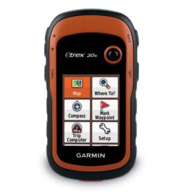
Garmin eTrex 20x Handheld GPS
Original price was: ৳ 24,500.৳ 23,500Current price is: ৳ 23,500.
Reviews
There are no reviews yet.