
- Your cart is empty
- Continue Shopping

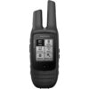

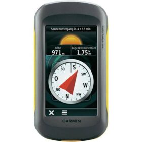
Garmin Montana 680t Handheld GPS

Garmin Montana 680t Handheld GPS
Garmin Montana 680t Handheld GPS
Garmin Montana 680t Handheld
Montana 680t has a built-in 3-axis tilt-compensated electronic compass, which shows your heading even while you’re on the move or not holding it level. The barometric altimeter tracks changes in pressure to pinpoint your precise altitude.Or use it to plot barometric pressure over time to help keep an eye on changing weather conditions.
Specifications :
| Physical dimensions | 2.9″ x 5.7″ x 1.4″ (7.48 x 14.42 x 3.64 cm) |
| Display size | 2″W x 3.5″H (5.06 x 8.93 cm); 4″ diag (10.2 cm) |
| Display resolution | 272 x 480 pixels |
| Display type | bright, transflective 65k color TFT, dual-orientation
touchscreen; sunlight readable |
| Weight | 10.2 oz (289 g) with included lithium-ion battery pack;
11.7 oz (333 g) with 3 AA batteries (not included) |
| Battery | rechargeable lithium-ion (included) or 3 AA batteries
(not included); NiMH or Lithium recommended |
| Battery life | up to 16 hours (lithium-ion); up to 22 hours (AA batteries) |
| Water rating | IPX7 |
| High-sensitivity receiver | Yes |
| Interface | high-speed USB and NMEA 0183 compatible |
| Ability to add maps | Yes |
| Basemap | Yes |
| Waypoints/locations/favorites | 4000 |
| Routes | 200 |
| Track log | 10,000 points, 200 saved tracks |
| Barometric altimeter | Yes |
| Compass | Yes (tilt-compensated 3-axis) |
| Area calculation | Yes |
| Sun and moon information | Yes |
| Picture viewer | Yes |
Related products
 Out of stock
Save 5%
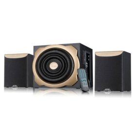
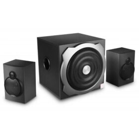
F&d A520U Heart Thumping Multimedia Speaker
Original price was: ৳ 4,000.৳ 3,800Current price is: ৳ 3,800.

 Out of stock
Save 4%
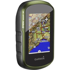
Garmin eTrex Touch 35 Handheld GPS
Original price was: ৳ 36,000.৳ 34,500Current price is: ৳ 34,500.
 Out of stock
Save 2%
Garmin Montana 600 Handheld GPS
Original price was: ৳ 43,000.৳ 42,000Current price is: ৳ 42,000.
 Out of stock
Save 4%
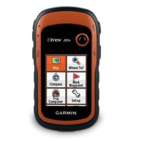
Garmin eTrex 20x Handheld GPS
Original price was: ৳ 24,500.৳ 23,500Current price is: ৳ 23,500.
 Out of stock
Save 3%
F&D A521 2:1 Multimedia Speaker
Original price was: ৳ 4,000.৳ 3,900Current price is: ৳ 3,900.
Reviews
There are no reviews yet.